
Palo Town Treasure Chart Arcane Odyssey Guide: Map, Route, and Digging Tips
If your chart points to Palo Town, the useful answer is not a single guessed hole. Select Palo Town in the Arcane Odyssey Treasure Chart Locator, match the exact compass direction and distance, then use the island's docks, settlement, trees, open edges, and elevation as practical filters.
Published | Updated | By Arcane Tools Editorial Team
Scope and sources
This is a fan-made location guide built around the Palo Town map already used by the Arcane Tools locator. It explains a repeatable search method; it does not claim that every chart uses the same final terrain or coordinate.
For official game context, see Arcane Odyssey on Roblox.
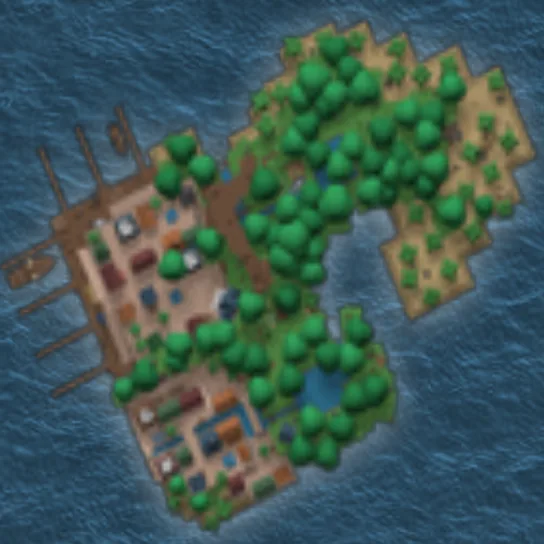
A Palo Town treasure chart Arcane Odyssey search is more manageable when you separate map orientation from exact clue solving. The island is compact enough that the three distance choices can feel deceptively similar, while the dock-heavy settlement and tree-covered center can make a correct zone look different depending on your approach. The goal is to narrow the search without pretending that the locator replaces the chart text or the live game terrain.
The Arcane Odyssey Map Guide handles world routing, the locator draws the direction wedge and distance band, and this page turns that band into a Palo Town walking and digging pattern. For general mechanics, start with the Treasure Chart Guide.
Palo Town treasure chart quick facts
Use the table as a pre-dig checklist. It intentionally stays broad: Treasure Charts describe a search area, and map images are best at helping you eliminate the wrong side of the island before you spend shovel attempts.
| Topic | Short answer | Why it matters |
|---|---|---|
| Region | Bronze Sea | Palo Town is one of the Bronze Sea islands supported by the Arcane Tools locator. |
| Best search intent | Palo Town map, route, and Treasure Chart help | The page is for a named-island clue, not a replacement for the general map guide. |
| Map character | Compact settlement, docks, trees, and open edges | Use these visual anchors to check whether the highlighted zone makes sense before digging. |
| Tool handoff | Select Palo Town, direction, and distance | The locator narrows the zone; the chart wording and live terrain decide the final spot. |
Use the Palo Town map before digging
Palo Town is a useful example of why a named island guide helps. The map includes a visible settlement and dock area, a dense wooded middle, and more open outer land. Those shapes are not separate chart mechanics, but they are excellent orientation anchors. When the locator highlights a zone, first ask which large visual area it overlaps. If the answer is “almost none,” check the island, direction, or distance setting before digging.
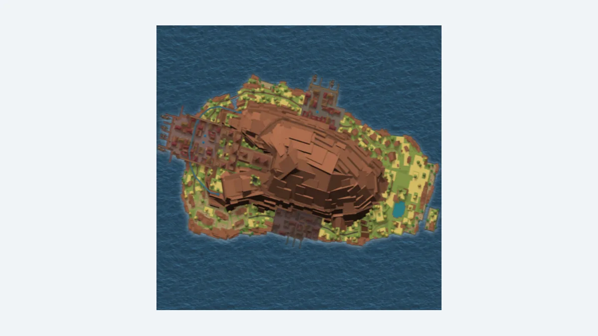
Keep the map in the role of a filter. It can tell you that a sweep is headed toward the settlement side, the wooded center, or an outer edge. It cannot tell you which small patch of ground is valid without the chart's terrain wording, so do not stop at the first visually plausible spot without checking all clue layers.
How to solve a Palo Town Treasure Chart in Arcane Odyssey
Work from the most reliable filter to the least precise one. Island name and exact direction should be locked before you interpret distance. Terrain and elevation then decide where to test inside the highlighted area.
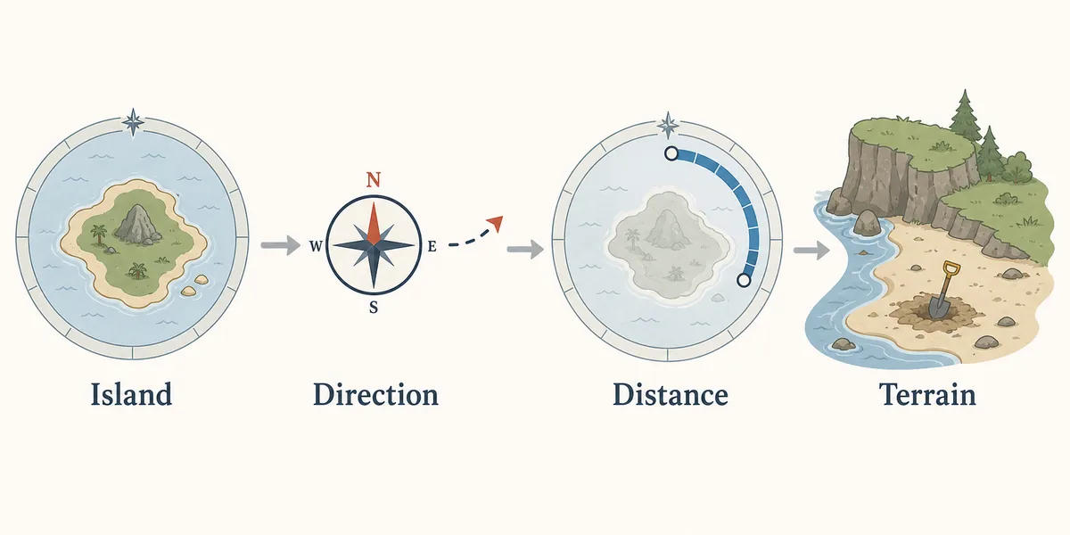
| Clue layer | What to check | Palo Town habit |
|---|---|---|
| Island | Confirm that the chart names Palo Town | Do not begin from a similar Bronze Sea island just because the map shape looks familiar. |
| Direction | Match the exact 16-point compass wording | Keep secondary directions such as east-southeast or north-northeast instead of rounding them. |
| Distance | Choose Few paces, Halfway, or On the edge | A compact island can make the rings feel close together, so use the wording literally. |
| Terrain | Compare the zone with ground, coast, trees, or open space | Terrain clues remove false positives that still sit inside the broad highlighted wedge. |
| Elevation | Check whether the clue implies low ground, a slope, or higher terrain | The correct horizontal area can still fail if you search at the wrong height. |
A clean five-step sweep
- Open the locator and select Palo Town.
- Match the chart's exact 16-point direction; do not round a diagonal.
- Choose Few paces, Halfway, or On the edge.
- Compare the highlighted zone with the dock, trees, open ground, and elevation clues.
- Dig in a short line or arc, record what failed, and change one assumption at a time.
Palo Town search zones and terrain checks
Do not read “Palo Town map” as a promise that every visible patch is interchangeable. A chart may still distinguish ordinary ground from a shoreline, a wooded section, or a raised part of the island. Use the following zones to organize your movement, not to replace the actual clue.
| Visual zone | What it helps you see | How to use it |
|---|---|---|
| Dock and settlement side | Dense structures, paths, and shoreline edges | Use it as a visual anchor, then inspect the surrounding ground rather than digging through every building. |
| Tree-covered middle | A broad green visual mass that can hide distance mistakes | Walk a clean line through the likely zone and keep track of tested spots. |
| Open outer areas | Less clutter and more obvious island boundary | Useful for edge clues, but do not assume every coastline point is a valid dig surface. |
| Water boundary | A hard map edge that helps orient the island | Treat the shore as orientation, not proof that the treasure is directly beside the water. |
“On the edge” does not automatically mean “beside the nearest pier.” Start with the outer band, then choose the part that matches the chart's surface. A “few paces” clue can still require a short walk if you arrive on the wrong side or use a shoreline landmark as the center.
When the first Palo Town sweep fails
A failed dig is useful evidence if you keep the test controlled. First confirm that the island name is correct. Next verify the direction, including the secondary compass point. Then check the distance ring. Only after those three checks should you reinterpret the terrain or elevation wording.
Reset rule
Do not change island, direction, distance, and terrain assumptions at once. If the first line fails, write down what you tested, widen the sweep within the same zone, and change only the clue layer that is least certain.
If the zone is broad, begin at the nearest obvious edge, walk toward its center, then arc across likely ground. This is easier to review than disconnected holes and helps expose elevation or “halfway” mistakes.
Common Palo Town treasure-chart mistakes
Most wasted trips come from an almost-correct setup. The island is right, but the direction is rounded; the zone is right, but the player searches the wrong height; or the map is used as an exact answer instead of a narrowing tool.
| Mistake | Why it hurts | Better habit |
|---|---|---|
| Rounding the direction | A diagonal clue can move the highlighted wedge toward a different shoreline. | Use the exact direction shown on the chart and in the locator. |
| Treating the map as a coordinate | The locator shows a search area, not a guaranteed pixel or final dig point. | Combine the zone with terrain, elevation, and the shovel result. |
| Searching only the town | The settlement is memorable, but a clue can point toward trees or open outer ground. | Use the map's main visual zones instead of assuming the buildings are the answer. |
| Ignoring distance wording | Few paces, halfway, and on the edge can land in very different parts of a small island. | Change only one clue input at a time when a first sweep fails. |
| Digging without a reset pattern | Repeated guesses make it hard to know whether the direction or terrain was wrong. | Mark your tested line mentally, then widen the search in a controlled arc. |
Related Arcane Tools pages
Use the Treasure Chart Locator for the interactive Palo Town direction wedge and distance ring. Read the general Treasure Chart Guide for chart mechanics and rarity context. If you are deciding how to reach the island, open the Map Guide; if you are collecting more scrolls or gear first, see the Chest Locations Guide or the Shovel Guide.
Palo Town Treasure Chart FAQ
Is there a Palo Town treasure chart guide for Arcane Odyssey?
Yes. This Palo Town treasure chart Arcane Odyssey guide explains how to use the island map, match the exact direction and distance, and filter the locator zone with terrain and elevation clues. It is a practical search guide, not a promise of one fixed coordinate for every chart.
How do I use the Arcane Odyssey Treasure Chart Locator for Palo Town?
Open the locator, select Palo Town, match the chart's 16-point direction, and choose Few paces, Halfway, or On the edge. Use the highlighted wedge as your starting zone, then compare it with the map shape and the chart's terrain wording before digging.
Where should I look first on the Palo Town map?
Start with the part of the island that matches both the distance ring and the direction. Use the dock and settlement side, tree-covered middle, open outer areas, and coastline as orientation anchors, but let the clue's terrain and elevation decide which anchor is relevant.
What does halfway mean for a Palo Town Treasure Chart?
Halfway means the middle distance band from the island's center in the locator model. On a compact island it can look close to the inner or outer band, so check the ring first and then use terrain to choose the safest places to test.
Why can I not find treasure even when the Palo Town zone looks correct?
The most common causes are a rounded compass direction, the wrong distance option, a missing elevation clue, or a terrain mismatch. Re-check the island and exact controls, then search one controlled line or arc instead of scattering random holes.
Final takeaway
The best Palo Town treasure chart route is repeatable: confirm the island, match direction, set distance, compare terrain and elevation, and dig in a controlled pattern. Use the map to remove wrong areas and the chart to choose the surface instead of turning a small Bronze Sea island into a random hole-by-hole search.